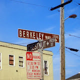
經過一翻努力後, 終於把兩種整合在一起了. 也就是在路線圖中, 照片直接顯示在拍照的地點, 而且是小圖. 如果還要看仔細一點, 點一下小照片就會連結到picasa的大照片了. 可說是非常完美.
View Larger Map
Posted by
SK
at
晚上7:28
2
comments
![]()
 |
| Berkeley bike 20080102 |
Posted by
SK
at
晚上10:16
0
comments
![]()
Posted by
SK
at
下午4:45
0
comments
![]()
事實上picasa我已用一段時間了, 不過用picasa的目的主要是將相片上傳到google. 其他那些附加功能都沒想要用.
直到前幾天在整理相片的時後, 不小心用的了I'm feeling lucky的修片功能. 結果發現修出來的照片相當的不錯, 對比加深, 照片變清楚多了. 後來乾脆用batch的功能, 把所以相片都修一修.
修片前:
修片後:
Read more !
Posted by
SK
at
凌晨12:03
0
comments
![]()
Label: google
我決定全面向google靠攏了.
我發現, 我的電腦越來越google了. google提供了新奇好玩的軟體及服務
StarOffice, 相容M$的Office軟體, word, excel, powerpoint都可用.
google map
google earth
Picasa
Gmail
Blogger
Youtube
google checkout, 這讓我買東西貪了不少便宜.
以上,重點是完全免費, 這讓我如何不向它靠攏呢. 既然google要燒錢, 那我幹嘛搶著付.
Read more !
Posted by
SK
at
下午3:11
0
comments
![]()
現在, 在Google map上create這個path更簡單了.
直接在google map 的search上貼上kml的網路位置, 就可出現path. 然後再copy link to post 就可以了.
View Larger Map
Read more !
Posted by
SK
at
下午5:48
0
comments
![]()
Google map + Google Earth 真是越來越好玩了. 今天出門騎腳踏車, 順便把昨天起死回生的GPS帶著. 這樣邊騎就邊記錄下我的位置.
回到家後, 將gps的記錄檔匯入google earth稍加編輯. 把Berkeley bowl 和 Top dog 及幾個景點加進去. 再利用這個網頁把路徑overlap到google map上, 就可以完成下列這張今天騎車的路線圖了.
總距離: 13.35KM (距離是用這個軟體算出來的)
Read more !
Posted by
SK
at
下午3:46
0
comments
![]()